SUMP Central

Select Language

News

Lisabon postavlja “oslonce za noge” za bicikliste koji na semaforu čekaju zeleno svjetlo

Jedno od najdužih raskrižja u Lisabonu – posebno za bicikliste – je ono kod Entrecamposa. Preko 1.000 biciklista dnevno prijeđe kružni tok Entrecampos, gdje se – kao što je još uvijek slučaj u mnogim drugim gradovima diljem svijeta – prednost daje automobilima, a ne aktivnoj mobilnosti, bilo da se radi o biciklističkom prometu ili pješačenju. Konkretno, biciklisti moraju čekati dva do tri puta duže na semaforu samo da bi prešli s Avenide da República na Campo Grande ili obrnuto, a to je samo nekoliko metara.

Kako bi pružili podršku biciklistima dok čekaju na raskrižju, gradsko vijeće Lisabona postavilo je prve „oslonce za noge“ u gradu, na dva od ovih semafora. To su mikroinfrastrukture koje biciklistima omogućuju da se oslone, odmore ruke i spuste noge. Ova vrsta mikro infrastrukture već postoji u drugim biciklističkim gradovima u Europi.

Prve dvije metalne konstrukcije, postavljene uz kružni tok Entrecampos, postavljene su uz biciklističku stazu i prije semafora, kako bi biciklisti mogli udobno čekati svoje zeleno svjetlo, a da pritom ostanu na biciklu. Na „osloncu za noge“ nalazi se rečenica koja objašnjava upotrebu konstrukcije, govoreći „spusti nogu ovdje…hvala što voziš bicikl!“. Ugradnja ove opreme dio je pilot projekta koji ima za cilj procijeniti percepciju korisnika o njezinoj vrijednosti, kako bi se utvrdilo treba li postaviti više „podnožja“ u drugim dijelovima grada.

S još dvije biciklističke staze koje se planiraju implementirati ove godine, Gradsko vijeće Lisabona pokazuje, postavljanjem ovih „oslonaca za noge“, svoju spremnost da nastavi ulagati i poboljšati biciklističku mobilnost. Biciklistički gradovi nisu samo dobro opremljeni odgovarajućom infrastrukturom, već nude i veću udobnost svim stanovnicima i posjetiteljima.

Ostaje za vidjeti hoće li ubuduće biti promjena u semaforima ili u dizajnu kružnog toka Entrecampos kako bi se prednost dala aktivnim i održivim načinima prijevoza, tako da prelazak na ovoj lokaciji ne oduzima toliko vremena i bude ugodniji za bicikliste. Od danas, biciklisti redovito improviziraju nove načine za smanjenje vremena provedenog na tom prijelazu, posebice kako bi se smanjilo vrijeme provedeno na tim semaforima.

Izvor: Eltis

Slučaj 15-minutnih gradova

Hélène Chartier, direktorica urbanog planiranja i dizajna u C40 Cities (Globalna mreža gradonačelnika vodećih svjetskih gradova koji su ujedinjeni u akciji za suočavanje s klimatskom krizom) objašnjava zašto takav pristup može stvoriti zelenije, sretnije, zdravije i uspješnije gradove.

SmartCitiesWorld (SCW): Koncept 15-minutnog grada više nije novost, no kako se danas definira?

Hélène Chartier (HC): Prošli urbani modeli – naročito oni razvijeni nakon Drugog svjetskog rata – sve više promiču širenje, planiranje orijentirano na automobile i pretjeranu specijalizaciju gradskih četvrti. Stambene zone odvojene su od poslovnih četvrti, komercijalnih površina i industrije, i svi su povezani prometnom infrastrukturom primarno namijenjene automobilima. Ovaj je model doveo do mnogih izazova s kojima se gradovi danas suočavaju: duga putovanja na posao, potrošnja prirodnog zemljišta, onečišćenje zraka, kao i nedostatak sadržaja i loša kvaliteta života u mnogim četvrtima.

Ovaj 15-minutni model grada predlaže viziju policentričnog grada sastavljenog od više “cjelovitih” četvrti, gdje svatko može zadovoljiti svoje svakodnevne potrebe u svojoj neposrednoj blizini.

Hitno trebamo stvoriti model urbanizacije koji je izgrađen u skladu s ljudima i prirodom. U tom smislu, 15-minutni grad je bio ključan u ubrzavanju rasprave, iako, kao što ste rekli, to nije novi koncept. Nakon modernističkog pokreta predvođenog Le Corbusierom, nekoliko urbanista poput američko-kanadske Jane Jacob, danskog Jana Gehla i novijeg francusko-kolumbijskog Carlosa Morena promovirali su model urbanog planiranja temeljen na blizini i javnim prostorima usmjerenim na ljude.

Ovaj 15-minutni gradski model predlaže viziju policentričnog grada sastavljenog od više “cjelovitih” četvrti, gdje svatko može zadovoljiti svoje svakodnevne potrebe u svojoj neposrednoj blizini.

To također ne znači da ta područja postaju previše “intenzivna”; to samo znači da postoji oblik zajednice, pristup parkovima i prirodi, pristup prometu, kulturi, restoranima i ključnim trgovinama za ljude koji žive u susjedstvu, kao i dobro dizajnirane ulice i javni prostori koji mogu djelovati kao “dnevni boravak susjedstva” – mjesto gdje se ljudi mogu družiti i osjećati ugodno u šetnji.

Mnogi gradovi uključuju četvrti koje to pružaju, ali obično su koncentrirane u središnjim ili bogatijim područjima. 15-minutni grad je pružanje takvog uspješnog lokalnog okruženja, za sve u svakom susjedstvu.

SCW: U Ujedinjenom Kraljevstvu trenutačno postoji neka vrsta reakcije protiv pokreta 15 minuta i čak je ispolitiziran. Mnogi argumenti vrte se oko stava da se radi o napadu na automobile – kakav je vaš odgovor?

HC: Ne bih to nazvala reakcijom. Ono što se događa je da na društvenim mrežama mala skupina alt-desničarskih ekstremista gradi teoriju zavjere uglavnom temeljenu na besmislicama i lažima. Tvrde da je 15-minutni grad neka vrsta “klimatske blokade” koja sprječava ljude da napuste svoje susjedstvo. Nijedan grad nikada nije zamislio napraviti takvo što, a to je vrlo daleko od onoga što koncept zapravo jest.

Postoji potpuna nepovezanost između ove buke na društvenim mrežama i stvarnosti o tome kako “pravi” građani i gradovi smatraju koncept 15-minutnog grada.

Diljem svijeta sve više i više ljudi prepoznaje da moramo transformirati naše gradove, a studije i simulacije ilustriraju prednosti toga. To je klimatski najprihvatljiviji model za gradove i prema Međuvladinom panelu o klimatskim promjenama (IPCC), kompaktni i resursno učinkoviti gradovi, sa zajedničkom lokacijom stambenih i radnih mjesta, mješovitim korištenjem zemljišta i dobrim pristupom javnom prijevozu, mogu pomoći u smanjenju gradskih emisija za oko 25 posto.

Postoji potpuna nepovezanost između ove buke na društvenim mrežama i stvarnosti o tome kako “pravi” građani i gradovi gledaju na koncept 15-minutnog grada. U Oxfordu, jednom od mjesta gdje se proširila ova teorija zavjere, lokalni izbori utješili su lokalnu vlast koja je promovirala 15-minutni grad. U međuvremenu, nedavna anketa koju je proveo Yougov pokazala je da bi 62 posto Britanaca željelo živjeti u 15-minutnoj četvrti.

SCW: Možete li navesti neke primjere pristupa koje gradovi zauzimaju?

HC: U Bogoti, gradske četvrti Barrios Vitales (Vitalne četvrti) uključuju određena područja prilagođena djeci i sustav skrbi oko škola i društvenih centara u kojima ljudi, uključujući starije osobe i žene s niskim primanjima koje skrbe o djeci, mogu pristupiti uslugama kao što su obrazovanje, preventivna zdravstvena zaštita i rekreacija.

U Parizu, gdje su 15-minutna načela pokretala urbanističko planiranje od 2020., 168 “školskih ulica” već je zamijenilo automobile igralištima i zelenilom. Razvili su i program pod nazivom Oaza školskih dvorišta koji se sastoji od ozelenjavanja školskih dvorišta i otvaranja istih izvan radnog vremena škola, primjerice vikendom i tijekom praznika. Pariz je tako stvorio više od 100 novih javnih parkova u četvrtima u kojima nema zelenih površina.

Nedovoljno opslužene četvrti također dobivaju potporu koja je revitalizirala lokalna gospodarstva, uključujući pekare, zanatske radnje i knjižare koje su dugo bile oslonci njihovih zajednica.

Los Angeles unapređuje jednu od svojih najnepovoljnijih četvrti skupom koordiniranih projekata uključujući pristupačno stanovanje, mogućnosti prijevoza s niskim udjelom ugljika, sadnju više od 3300 stabala i razvoj lokalnih sadržaja kako bi se odgovorilo na potrebe zajednice.

Tu je i Vancouver, koji je ovu viziju ugradio u svoju strategiju planiranja čitavog grada. Koncept cjelovitih četvrti ključna je komponenta nedavno odobrenog Vancouver Plana. Plan uključuje politike korištenja zemljišta kako bi se novi izbori stanovanja usmjerili na stambena područja niske gustoće koja su bogata sadržajima te kako bi se dodale mogućnosti za nove sadržaje i usluge u nedovoljno posluženim područjima. Također planira stvoriti integriranu mrežu javnih prostora, ekoloških koridora, zelenih staza s aktivnim načinima putovanja.

SCW: Vidite li da gradovi postaju skup 15-minutnih četvrti?

HC: Da, na neki način, ali veličina grada, naravno, još uvijek ima smisla. I važno je da je svaki „cijeli kvart” povezan s ostatkom grada, posebno sustavom javnog prijevoza. Zapravo, mnogi gradovi koji planiraju svoju 15-minutnu gradsku strategiju smatraju tranzitnu stanicu jednom od ključnih usluga kojoj bi svaki stanovnik trebao imati pristup u svom susjedstvu.

Petnaestominutne gradske politike i akcije trebaju se definirati na temelju svake tipologije susjedstva i oko potreba lokalnih zajednica. Mnogi gradovi započinju mapiranje i uspostavljanje temelja postojećih sadržaja unutar svakog susjedstva. Što im nedostaje i kakvu namjenu žele? Kako se mogu poboljšati javni prostori?

 Mnogi gradovi koji planiraju svoju 15-minutnu gradsku strategiju smatraju tranzitnu stanicu jednom od ključnih usluga kojoj bi svaki stanovnik trebao imati pristup u svom susjedstvu.

Ako ste u središtu Pariza ili Barcelone, na primjer, već imate minimalnu gustoću potrebnu za održive usluge i sadržaje, tako da je fokus na stvaranju više zelenih površina i redizajniranju javnih prostora prema potrebama ljudi, a ne automobila, kako bi se ljudi mogli družiti i osjećati sigurno hodajući i vozeći bicikl.

S druge strane, Melbourne je identificirao tri 20-minutna pilot naselja koja su rezidencijalna naselja niske gustoće, uglavnom sastavljena od obiteljskih kuća. Fokus je stoga poboljšati kvalitetu života stanovnika pružanjem većeg izbora stanovanja kroz izgradnju naselja i revitalizaciju glavnih ulica s više sadržaja i usluga.

SCW: Mogu li gradovi također imati koristi od 15-minutnog pristupa gradu, posebno oni koji su zbog putovanja na posao u veća mjesta ili gradove izgubili puno vremena tijekom dana?

HC: Da, razgovarala sam o tome s Chrisom Jonesom sa Sveučilišta Berkeley, koji je spomenuo da je kompletno susjedstvo poput dobro planiranog grada mješovite namjene. Međutim, način na koji su se neki gradovi razvili znači da može postojati mnogo sekundarnih ili tercijarnih područja koja su upravo stvorena kao stambene četvrti. Ljudi ih često napuštaju ujutro kako bi putovali na posao i vraćali se navečer, što ih čini gotovo spavaonicama.

Tome je pridonijeo trend da središnje stanice u velikim mjestima ili gradovima postanu gotovo poput trgovačkih centara za putnike prije i poslije posla. To može imati negativan učinak na njihova susjedstva jer ne koriste trgovine u njima. Međutim, transformacija radnog mjesta znači da će se to vjerojatno promijeniti. Covid je promijenio perspektivu i nitko ne misli da je više u redu provoditi dva sata putujući na posao.

SCW: Što je sljedeće za C40 u smislu pojačavanja 15-minutne gradske poruke i podrške većem broju gradova za stvaranje uspješnih četvrti?

HC: Sada stvaramo međunarodni forum gradskih praktičara za gradove kako bi razmjenjivali znanja o tome kako mogu stvoriti zelene i uspješne urbane četvrti. U tri mjeseca Forumu se već pridružilo više od 35 gradova diljem svijeta, a 25 gradova predložilo je 15-minutne pilote susjedstva u čijoj će im provedbi C40 podržati.

Ideja je da radimo s njima u nadolazećim godinama kako bismo identificirali niz konkretnih radnji – poput školskih ulica ili programa za prazne trgovine – kako bismo vidjeli kako bismo mogli poboljšati kvalitetu života i održivost. Identificirali smo 10-15 tipova akcija koje ćemo predložiti i raspraviti s lokalnom zajednicom u skladu s njihovim potrebama, a zatim podržati grad da ih provede sa skupinom stručnjaka.

Rasprava o 15-minutnim gradovima odvija se posvuda, od Indije do Kine i Sjeverne do Južne Amerike i diljem svijeta. Možemo puno naučiti od globalnih južnih gradova koji su zadržali neke od razvoja o kojima ovdje govorimo i gdje su, na primjer, javne tržnice još uvijek značajne.

Moramo pomoći gradovima da ubrzaju ove 15-minutne gradske ideje i integriraju ih u svoju viziju i planiranje. Razgovor između gradova mora se nastaviti.

Kao i radni tok C40 na 15-minutnom programu Grad i Zelena i uspješna susjedstva, Hélène Chartier vodi mrežu planiranja korištenja zemljišta C40 koja podržava gradove da institucionaliziraju klimatske akcije kroz propise urbanog planiranja, natjecanje Reinventing Cities koje donosi dekarbonizirane i otporne urbano-regeneracijske projekte.

U prošlosti je bila savjetnica gradonačelnice Pariza, Anne Hidalgo. Također je radila za Parišku agenciju za urbanizam i globalnu konzultantsku tvrtku Arup. Chartier ima magisterij iz znanosti i inženjerstva na Ecole Centrale, sa specijalizacijom u građevinarstvu. U posljednjih 15 godina Helene je živjela i radila u Parizu, Londonu i New Yorku.

Hélène Chartier jedna je od govornica na SmartCitiesWorld Cities Climate Action Summitu koji se održava od 18. do 20. travnja 2023.

Izvor: The case for 15-minute cities – Smart Cities World

Saving digital privacy from shared mobility in Amsterdam

As cities across Europe move to decarbonise urban transport and reduce private car use, shared mobility plays a paramount role in their efforts. Renting a shared vehicle instead of owning one and combining it with public transport, for example, is an increasingly popular choice in places like Antwerp, Milan and Bremen.

Shared vehicle apps, in return, collect real life data that municipalities utilise to advance their sustainable mobility plans and determine where new infrastructure is most needed. For example, aggregating data from car sharing apps can identify popular spots and advise local authorities where to build parking spaces or pedestrian paths best.

On the upside, shared mobility data considerably helps city officials to make informed decisions. If misused, however, the information may accidentally reveal personal details and impinge on users’ right to privacy.

A Smart Mobility Project Manager in the city of Amsterdam, Gemma Schepers, stated: “As local governments, we need to protect people. We don’t need to collect so much data and become a surveillance state. I don’t think this is what the European Union wants.

Municipalities have little choice but to improvise in a relatively new field lacking clear standards for processing information safely. “A comprehensive research that we conducted some two years ago among European cities showed that not many of them exchange data according to EU laws and regulations,” Schepers explains.

Enter Amsterdam’s City Data Standard for Mobility (CDS-M), a new data-sharing manual allowing cities to research mobility data while respecting users’ privacy rights. 

The model is based on the EU’s stringent General Data Protection Regulation (GDPR). Boasting a dedicated website, the CDS-M website offers a comprehensive step-by-step guide with commonly used cases that municipalities can replicate on their territories.

How it works

A vital feature of this method is the use case store, a library of common urban challenges and instructions on how to conduct data analysis without intruding on people’s privacy . Don’t let the word ‘store’ fool you: CDS-M is free.

Each use case provides a list of data exchange standards graded into five categories, with A indicating a safe non-personal data level and E an “excess of personal data or unlawful processing.”

To begin using CDS-M, municipalities must first define the challenges for which users’ data is necessary. “You always need to start with the question: what is the problem in your city? Because if you have a parking problem, you don’t need people’s private information to determine your course of action. You always need to ensure that you collect as little data as possible,” Schepers remarks. For example, how to identify popular routes that need infrastructural works, such as new parking facilities or larger curbs?

To complete that specific task, the CDS-M website’s use case shows municipalities need only generic travellers’ information. That is mobility data of type A and B devoid of individual names, bank details and trip patterns that could give out unnecessary personal information.

For Edwin van der Belt, a software architect at consultancy Dat.Mobility, the conclusion is that cities don’t really need to exploit users’ private information in order to plan their policy actions.

Personally, I’m convinced that all data exchanges can be conducted with an A or B,” says van der Belt, who worked with Amsterdam on the CDS-M tool.

A free tool for all cities

For almost three years, the Dutch city worked to fully develop and implement its model. The team started to work in 2019 and later put CDS-M to the test by running five pilots in Utrecht, Groningen, Eindhoven, Amsterdam and Rotterdam.

Now, the next step is to take CDS-M beyond national borders.

It took a lot of specialized knowledge and finance to generate our model and since not every city has the capacity and means to do this kind of research, we hope to provide a footprint that can facilitate other municipalities’ work,” Schepers says.

With digital media generating increasing privacy concerns, the Smart Mobility Project Manager hopes to go beyond the technical aspects to put personal data front and centre in a Europe-wide conversation.

Even if not everyone will use our way of working, we hope to create a lot of awareness. In the Netherlands, CDS-M generated a lot of discussions on data exchange and privacy and we hope to elicit the same interest outside of our country,” Schepers explains.

For more information, see the original article at Amsterdam wants to save your digital privacy

Bridging urban-rural transport divides

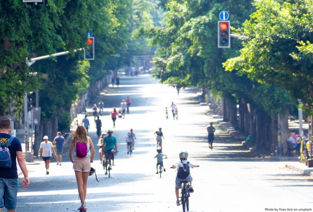
Urban mobility is much more than transit across the metropolis. Journeys do not stop at the city limit, there is a continued to and from the periphery to the core and between cities themselves.

Rural areas cover more than 80 % of the total EU territory and are home to 30% of the EU population. Mobility is the glue that binds together rural communities and helps local economies flourish. However, our peri-urban and rural communities are often left behind in sustainable mobility agendas. Policy, funding, planning, and research are not given the same attention as in urban areas. We have seen a flurry of investment and political focus on reducing car dependency in cities and major urban areas with Low Traffic Neighbourhoods, School Streets and car-free cities, yet less focus on sustainable accessible, and affordable alternatives for suburban and rural areas.

The interactive webinar ‘Addressing urban-rural transport divisions’ examined the challenges facing practitioners and policymakers, identifying gaps in the current research and how innovative approaches can cement long-term solutions for bridging urban-rural transport divisions.

Aided by expert input from Laurie Pickup, International Director, SLR Consulting and past chair of the International Transport Forum’s global working group on Transport Innovation for the Periphery, and Jenny Milne, Founder and Director of the Scottish Rural and Islands Transport Community (SRITC) who is currently conducting a PhD on Rural MaaS, this Just Transition Webinar brought the periphery centre stage, shining a spotlight on rural mobility planning.

The great divide & why rurality matters

Once we move beyond the city core, car dependency rockets. For example, Eurostat figures reveal that in Greater Manchester, the share of people using a car to get to work was 18.3% higher in the surrounding region than in the city centre (71.1% vs 52.8%).

This is underpinned by multiple, complex components, including territorial, socio-economic, and demographic factors; yet, at the heart of this division, there is a Europe-wide underinvestment in more sustainable and accessible alternatives in rural and peri-urban areas.

In rural areas, low mobility hurts much more,” asserted Pickup. “Cities may be focused on carbon zero, and this is important to regions, but not as much as accessibility right now!”

Rural transport is a concern not just for regions, but cities too.

It is estimated that each day, more than a million people commute into the city of Paris, while Lisbon, Madrid and Brussels see more than half a million commuters arriving per day. In Greater Manchester, 60% of commuter trips to the centre are from rural areas outside the city- figures which have not been significantly affected by the pandemic.

Indeed, as previous POLIS Regions Working Group meetings have revealed, without channelling investment into rural areas, decarbonisation, decongestion and modal split goals everywhere are jeopardised.

The Future of Transport Outside Cities report, exposed that areas outside major cities account for over 70% of national transport emissions, paired with public transport cuts in rural areas across Europe leaving “Transport Deserts” where many are left without affordable or accessible options, action is needed — fast!

“Lack of transport hurts those in rural areas the most, we are seeing a growing interest and pressure for action at national and EU level on this, but there is still much to be done,” stated Pickup.

From Catalonia’s on-demand bus services to FrankfurtReinMain’s integrated cycleway network, to Stavanger’s multi-modal integration – regions across Europe are endeavouring to enhance and expand public transport and active travel provisions. Nevertheless, there is a long way to go.

Why is there such a division?

Rural transport faces a series of critical challenges which make services both physically and economically challenging to coordinate and deliver.

In many cases, the term “Transport Desert” has been used to describe many rural settlements which are inappropriately served by public transport in a way that’s likely to limit choices and opportunities for the people who live there.

The economic case – particularly post-pandemic as transport operators struggle to recover lost revenue, is (to put it mildly) tricky. It is estimated that, globally, 85% of rural bus operators run below the break-even point. However, passenger numbers remain low; in Scotland, the number of bus journeys dropped by 65% in 2020-21 following a generally declining trend which had seen bus passenger numbers drop by 21% in the ten years leading up to 2019-20.

At the same time, limited supply of services, timetabling, vehicle design and poor integration of transport with local services has left many rural areas cut off- and Milne presented a range of cases from Scotland where this is causing significant challenges for locals and visitors alike.

Distance is a major challenge, particularly for active travel infrastructure. With far greater distances between services, where more active modes are being successfully used to replace short car trips in urban districts, this solution is far harder to deploy in more dispersed areas. As the UK’s travel time statistics reveal, the average minimum cycle time to key services in rural areas is 30 minutes, compared to just 15 minutes in urban areas, while the average walking time in rural areas is almost 1 hour. Given that the rural population are, on average, older than in urban areas, distance and complexity of travel are key in shaping transit choices.

Yet, as Milne reminded the webinar, this is not a justification for under-investment- quite the opposite, the investment pays.

Rural areas make up just 20% of the population, yet they contribute to 25% of the country’s GDP,” she asserted. “We need to invest in our rural areas, and fully recognise their value.”

Tackling the division: A crucial moment for action?

Jenny Milne presented the work being conducted by SRITC in creating a collective voice for rural and island communities, organisations, and businesses, building a network that can deliver a better transport futurerepresent the transport needs of residents to those who can facilitate change; and facilitate knowledge and best practice exchange to support innovative solutions to key transport challenges.

She revealed how COVID-19 has undoubtedly transformed the conversation. The onset of more flexible working conditions has, in many regions, seen a “return” to rural living; while this influx of new residents has in many cases placed a strain on communities (rising house prices etc), it has opened the door for new approaches to more flexible rural connectivity.

The pandemic also opened up new channels for those working on these issues to be able to share ideas and experiences- bringing rural mobility challenges to the fore of national and international agendas.

“The explosion in digitally enabled ways of working has transformed how we can discuss these issues, the forums we can access and the exchange of ideas we, in rural areas, can have,” said Milne.

From the periphery to the core! A new language for rural mobility

As part of a more comprehensive planning process, both speakers called for a move away from the copy-and-paste approach to rural mobility so often adopted.

“It is not a competition of rural vs urban, we need to view the issues as a whole, beyond the current Siloed approach,” stated Milne.

The webinar presented a clear necessity for a specific focus on rural areas within mobility planning; however, critically, both Pickup and Milne were not advocating a bifurcation of urban and rural planning, but rather an improved integration of transport agendas, with stakeholders working together more comprehensively.

“We need a complete change of language we use,” echoed Pickup. “Away from rural areas simply being the ‘periphery’, towards independent areas with their own unique needs and demands.”

Indeed, the urgency for this is clear when examining urban mobility planning. A Sustainable Urban Mobility Plan (SUMP) is a strategic plan designed to satisfy the mobility needs of people and businesses in cities and their surroundings for a better quality of life. Most- if not all- cities in Europe have one, yet, we do not treat our regions with quite the same strategic approach.

Pickup presented some key findings from the SMARTA project, which explored the key challenges of mobility in Europe’s rural areas and the existing frameworks available, before pressing for EU action.

“We looked at how we currently plan for mobility in rural areas,” described Pickup, “And the answer is… we don’t!”

Several POLIS member regions have- or are in the process of developing such plans. National Transport Authority Ireland’s (NTA) Connecting Ireland Plan seeks to bridge gaps, address uneven connectivity, and integrate timetables, while FrankfurtRheinMain’s SUMP aims to boost sustainable modes of transport up to 65% by 2030, helping to reach the EU climate goal of reducing CO2 emissions by 55% by the same year.

Yet, as Pickup noted, there is a clear necessity to create more comprehensive planning and investment strategies, which work from the bottom up, moving from the needs of rural inhabitants to the types of mobility solutions which are developed.

There are a lot of assumptions about what rural mobility should be, and how it should be configured, often emanating from decision-makers in urban areas,” asserted Milne.

This has been a large part of the work being done at SRITC, which has been endeavouring to move rural mobility needs further up the national agenda. It submitted 6 “big asks” to the Scottish Government, which, if supported will bring much greater focus to the work that needs to be done to “level up” and decarbonise rural and island communities:

Through these actions, SRITC seeks to secure additional support for rural mobility planning, yet retain local actors at the heart of design and decision-making.

Moving from pilots to long-term processes

Yet, one of the biggest challenges is how to develop mobility approaches that can be sustained in the long term. Scaling up and transferring products and approaches demands political and financial viability, and too often pilot projects do not result in a wider, systematic shift in how mobility is designed and delivered.

Lisbon installs “footrests” for cyclists waiting for lights to turn in their favour

One of the longest crossroads in Lisbon – especially for cyclists – is the one at Entrecampos. Over 1,000 cyclists per day cross the Entrecampos roundabout, where – as is still the case in many other cities around the world – priority is given to cars rather than to active mobility, whether that is cycling or walking. In particular, cyclists have to wait 2 or 3 times at traffic lights just to go from Avenida da República to Campo Grande, or vice versa, and it is only a few metres.

In order to support cyclists while they are waiting at the crossroads, Lisbon City Council has installed the first “footrests” in the city at two of these traffic lights. These are micro-infrastructure that allow cyclists to support themselves, rest their arms and put their feet down. This type of micro infrastructure already exists in other cycling cities in Europe.

The first two metallic structures, installed next to the Entrecampos roundabout, have been placed next to the cycle path and before the traffic lights, so that bike users can comfortably wait for their green light, while continuing to stay on their bicycle. On the “footrest”, there is a sentence explaining the use of the structure, saying “put your foot down here…thanks for riding a bike!”. The installation of this equipment is part of a pilot project that aims to assess users’ perception of its value, in order to identify whether to install more “footrests” in other areas of the city.

With two further cycle paths planned to be implemented this year, Lisbon City Council is showing, with the installation of these “footrests”, its willingness to continue to invest in and improve cycling mobility. Cycling cities are not only well equipped with adequate infrastructure, they also offer more comfort to all residents and visitors.

It remains to be seen whether there will be future changes in the traffic lights or in the design of the Entrecampos roundabout to give priority to active and sustainable transport modes, so that crossing at this location is not so time-consuming and is more comfortable for cyclists. As of today, cyclists regularly improvise new ways to reduce the time taken at that crossing, particularly to reduce time spent stuck at those traffic lights.

Helsinki renovates its main boulevard

The Finnish capital Helsinki has started the renovation of its main boulevard, the Mannerheimintie, in March 2023. Works will take more than two years to comlpete and have been called the largest urban renovation project the city has ever seen.

The boulevard is home to many of the important buildings of the Finnish capital, such as the national House of Parliament, the National Museum and the Helsinki Opera. Its infrastructure, such as that transporting sewage, has been in place since start of the 20th century or even earlier, which underlines the need for their renovation.

The project will take a two-phase approach to avoid having to close the entire street. In addition to the sewage and power supply infrastructure, the road’s tram tracks and the bridge over the Baana boulevard will also be renovated. In addition, the Mannerheimintie will be equipped with one-way bicycle lanes, which it currently does not have.

During the works, the street will be reduced to a single lane in each direction resulting in less capacity for car traffic and possible congestion. Liisa Taskila, project manager for the renewal of the boulevard, says: “We hope that this will be a time when people switch to public transport when entering the city centre, wherever possible. It’s worth considering alternative routes and whether it’s really necessary to take your own car or whether you could hop on a bus or tram”.

Article published first at TheMAYOR.eu on 7 March 2023.

Sustainable Transport Forum – new membership appointments

The Sustainable Transport Forum (STF) is the Commission’s main formal expert forum to support the implementation of the Union’s alternative fuels policies, contributing to the European Union’s energy and climate goals.

On 15 June 2015, the Directorate-General for Mobility and Transport (DG MOVE) appointed the initial member-organisations of the STF. Their mandate was extended until 31 December 2022.

On 19 October 2022, the European Commission published a new call for applications to re-establish the membership of the STF. The deadline for applications expired on 15 November 2022. The initial call for applications was however republished with deadline 16 December 2022 to attract more participation of civil society organisations, as well as EU associations representing professional transport users.

DG MOVE has now appointed the new members of the STF. As of 7 February 2023, the nominated members are:

Type C members (organisations)

For organisations, the mandate is subject to the registration in the Transparency Register.

Type D members (Member States’ authorities)

All EU Member States

Type E members (other public entities)

The appointment is valid until 31 December 2027, with an extension possibility.

The following organisations, authorities and/or public entities have been invited to attend the STF as observers (and the DG MOVE services may invite more):

HARMONY publishes Guidelines on Modelling tools for SUMPs in the new mobility era

Despite the acceleration of new mobility solutions and the increasing relevance of models in urban transport planning, particularly in the context of decarbonisation and climate neutrality, a clear, concise and up-to-date guidance document on modelling tools for the urban mobility planner’s community was missing.

The HARMONY project under the CIVITAS initiative, an EU-funded programme focused on sustainable and smart mobility, just published Guidelines on Modelling tools for Sustainable Urban Mobility Plans (SUMPs) in the new mobility era. The aim is to provide local planning authorities with guidance on transport modelling applications in their SUMP implementation process, building on the concept of SUMP, as outlined by the European Commission’s Urban Mobility Package and described in detail in the European SUMP Guidelines 2.0 (second edition).

The project highlighted the importance of a bottom-up approach in urban planning, through the implementation of co-creation labs in six metropolitan areas (Athens, Oxfordshire, Rotterdam, Trikala, Turin, and Upper Silesian-Zaglebie Metropolis), which gained experience and acquired knowledge on their mobility trends and future expectations from the application of transport modelling tools, but also from surveys and workshops.

Within this context, HARMONY Guidelines on Modelling tools are useful to assess new mobility technologies impacts in the urban environment, answering to questions related to transport models.

In particular, the document provides:

  • A definition and classification of transport models (micro, macro, network, strategic, land-use, activity based, etc.).
  • An understanding of their purposes and functions (to do experiments, anticipate the effect of exogenous trends and assess policy measures).
  • An analysis of their challenges and limits (data availability, realism vs operability, managing trend breaks and innovative solutions, etc.).
  • Guidance on how to decide whether a transport model is required or not to support the definition of a SUMP and how to select the most appropriate transport model, assuming that the transport model is required. 
  • An explanation on how to develop a transport model, which is a process requiring skills, data, time and resources. It describe the five main phases: 1) design; 2) data collection and elaboration; 3) implementation; 4) calibration; and 5) application.
  • Identification of the roles and responsibilities of the different actors involved in the development of a transport model, namely of experts (modelers), local authorities, planners, and stakeholders.
  • The main actions and elements essential for implementing transport modelling as part of the phases of the SUMP cycle. The document identifies crucial aspects and recommend concrete actions to the general guideline cycle, to encourage urban planners to better integrate transport modelling in their SUMPs.

The document has been drafted by TRT Trasporti e Territorio within the Harmony project, as part of the WP8 (Process assessment, SUMPs recommendations and roadmaps) activities, and takes advantage from the project achievements related to the development of the Harmony Model Suite and its application to case studies in Rotterdam (NL), Oxfordshire (UK), Turin (IT), Athens (GR).

For more information and to read the HARMONY Guidelines, check out the tool at Link:  HARMONY Guidelines on Modelling tools for SUMPs in the new mobility era

Brussels’ new traffic plan has reduced cars by one-fifth in the last six months

The authorities in the Belgian capital, Brussels, have announced the first results of the implementation of their Good Move Plan. The plan is the city’s mobility plan and aims to change the flow of traffic within the city, by closing some streets and creating new one-way streets within the city’s so-called ‘Pentagon’ – the main central area. The ultimate aim is to make the city a better place for residents and visitors.

Although the authorities note that it is still too early to draw comprehensive conclusions, the results after six months are promising. The plan already appears to be delivering its intended effects, as indicated by some initial findings including:

  • Reduced traffic flow in the central part of Brussels. Total traffic has fallen by around 19%. This figure was determined by counting the number of cars passing 45 intersections within the Pentagon. The first count was taken on 26 October 2021, while the second was on 8 November 2022, a couple of weeks after the plan was put into action.
  • Increased number of cyclists. 23% more cyclists have been counted in the morning rush hour and 13% more in the evening rush hour.
  • Improvements in some travel times. Driving the entire Kleine Ring, the boulevard around the Pentagon, took around one hour on 23 January 2023. That is five minutes faster than it took before the Covid-pandemic and about the same as in 2021. These improvements were not consistent across the board.
  • Reduced noise and cleaner air.

However, the plan has been met with some resistance. In the first week after the Good Move Plan was introduced, there were protests in the streets of central Brussels. Those participating were concerned that the plan would bring less traffic, and so less business into the area. According to a statement by the city, officials have taken the concerns of many residents into account.

The city’s Alderman for Mobility, and the main proponent of the plan Bart Dhondt, explained that local authorities weigh these concerns against the spirit of the plan and changes could be made where necessary. Alderman Dhondt was quoted in a press statement saying: “Many people have simply made a different mobility choice and switched to cycling or public transport, for example. The circulation plan thus contributes to the ultimate goal: a more pleasant city for everyone.”

Bucharest continues to make its traffic light system smarter

The mayor of the Romanian capital, Bucharest, Nicuşor Dan, has announced the signature of contracts that will continue to make the city’s traffic light system smarter. The contracts are being financed through the National Recovery and Resilience Plan (PNRR) and will take forward the modernisation and expansion of the city’s intelligent traffic light (ITL) system, as part of the Bucharest Traffic Management System (BTMS). The project has a total cost of approximately €25 million, of which €12.5 million are from non-refundable sources.

ITL systems are vehicle traffic control systems that combine traditional traffic lights with an array of sensors and artificial intelligence to intelligently route vehicle and pedestrian traffic. They help to improve traffic flow, increase road safety and reduce air pollution. According to the mayor’s announcement, the modernisation and extension of Bucharest’s ITL system will be carried out in four steps; the signed contracts cover the first three.

The first step involves the modernisation and reconfiguration of 85 intersections, relating to five radial routes into the capital to improve the operation of these important exits from the city centre, i.e.: Colentina Road, Alexandriai Road, Iuliu Maniu Boulevard, the Bucharest – Târgovişte Road and Berceni. This initial stage also includes the implementation of 220 electric vehicle charging stations in the capital.

The aim of the second step is to increase the capacity of the current traffic centre, while the third involves the modernisation in various stages of approximately 185 existing intersections, as well as the overall BTMS system. In addition, new vehicle detection solutions are being considered, such as the installation of video cameras, magnetic sensors, etc.

The fourth and final stage of the project will include the renewal of 194 existing intersections and the integration of these into the current BTMS. As part of this stage, 80 intersections or pedestrian crossings that currently do not have traffic lights will be added, so traffic lights will be installed on these and integrated into the BTMS. In order to realise these final investments and improvements, the City of Bucharest is planning to apply to other non-reimbursable financing programmes.