SUMP Central

Select Language

SUMP Central

Lisbon installs “footrests” for cyclists waiting for lights to turn in their favour

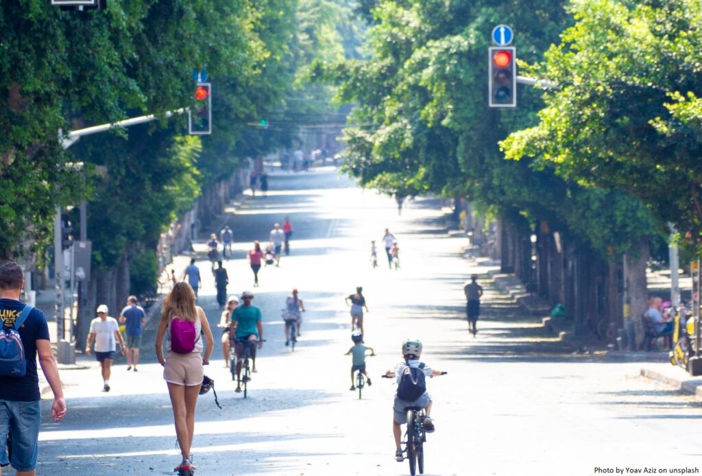
One of the longest crossroads in Lisbon – especially for cyclists – is the one at Entrecampos. Over 1,000 cyclists per day cross the Entrecampos roundabout, where – as is still the case in many other cities around the world – priority is given to cars rather than to active mobility, whether that is cycling or walking. In particular, cyclists have to wait 2 or 3 times at traffic lights just to go from Avenida da República to Campo Grande, or vice versa, and it is only a few metres.

In order to support cyclists while they are waiting at the crossroads, Lisbon City Council has installed the first “footrests” in the city at two of these traffic lights. These are micro-infrastructure that allow cyclists to support themselves, rest their arms and put their feet down. This type of micro infrastructure already exists in other cycling cities in Europe.

The first two metallic structures, installed next to the Entrecampos roundabout, have been placed next to the cycle path and before the traffic lights, so that bike users can comfortably wait for their green light, while continuing to stay on their bicycle. On the “footrest”, there is a sentence explaining the use of the structure, saying “put your foot down here…thanks for riding a bike!”. The installation of this equipment is part of a pilot project that aims to assess users’ perception of its value, in order to identify whether to install more “footrests” in other areas of the city.

With two further cycle paths planned to be implemented this year, Lisbon City Council is showing, with the installation of these “footrests”, its willingness to continue to invest in and improve cycling mobility. Cycling cities are not only well equipped with adequate infrastructure, they also offer more comfort to all residents and visitors.

It remains to be seen whether there will be future changes in the traffic lights or in the design of the Entrecampos roundabout to give priority to active and sustainable transport modes, so that crossing at this location is not so time-consuming and is more comfortable for cyclists. As of today, cyclists regularly improvise new ways to reduce the time taken at that crossing, particularly to reduce time spent stuck at those traffic lights.

Helsinki renovates its main boulevard

The Finnish capital Helsinki has started the renovation of its main boulevard, the Mannerheimintie, in March 2023. Works will take more than two years to comlpete and have been called the largest urban renovation project the city has ever seen.

The boulevard is home to many of the important buildings of the Finnish capital, such as the national House of Parliament, the National Museum and the Helsinki Opera. Its infrastructure, such as that transporting sewage, has been in place since start of the 20th century or even earlier, which underlines the need for their renovation.

The project will take a two-phase approach to avoid having to close the entire street. In addition to the sewage and power supply infrastructure, the road’s tram tracks and the bridge over the Baana boulevard will also be renovated. In addition, the Mannerheimintie will be equipped with one-way bicycle lanes, which it currently does not have.

During the works, the street will be reduced to a single lane in each direction resulting in less capacity for car traffic and possible congestion. Liisa Taskila, project manager for the renewal of the boulevard, says: “We hope that this will be a time when people switch to public transport when entering the city centre, wherever possible. It’s worth considering alternative routes and whether it’s really necessary to take your own car or whether you could hop on a bus or tram”.

Article published first at TheMAYOR.eu on 7 March 2023.

Sustainable Transport Forum – new membership appointments

The Sustainable Transport Forum (STF) is the Commission’s main formal expert forum to support the implementation of the Union’s alternative fuels policies, contributing to the European Union’s energy and climate goals.

On 15 June 2015, the Directorate-General for Mobility and Transport (DG MOVE) appointed the initial member-organisations of the STF. Their mandate was extended until 31 December 2022.

On 19 October 2022, the European Commission published a new call for applications to re-establish the membership of the STF. The deadline for applications expired on 15 November 2022. The initial call for applications was however republished with deadline 16 December 2022 to attract more participation of civil society organisations, as well as EU associations representing professional transport users.

DG MOVE has now appointed the new members of the STF. As of 7 February 2023, the nominated members are:

Type C members (organisations)

For organisations, the mandate is subject to the registration in the Transparency Register.

Type D members (Member States’ authorities)

All EU Member States

Type E members (other public entities)

The appointment is valid until 31 December 2027, with an extension possibility.

The following organisations, authorities and/or public entities have been invited to attend the STF as observers (and the DG MOVE services may invite more):

HARMONY publishes Guidelines on Modelling tools for SUMPs in the new mobility era

Despite the acceleration of new mobility solutions and the increasing relevance of models in urban transport planning, particularly in the context of decarbonisation and climate neutrality, a clear, concise and up-to-date guidance document on modelling tools for the urban mobility planner’s community was missing.

The HARMONY project under the CIVITAS initiative, an EU-funded programme focused on sustainable and smart mobility, just published Guidelines on Modelling tools for Sustainable Urban Mobility Plans (SUMPs) in the new mobility era. The aim is to provide local planning authorities with guidance on transport modelling applications in their SUMP implementation process, building on the concept of SUMP, as outlined by the European Commission’s Urban Mobility Package and described in detail in the European SUMP Guidelines 2.0 (second edition).

The project highlighted the importance of a bottom-up approach in urban planning, through the implementation of co-creation labs in six metropolitan areas (Athens, Oxfordshire, Rotterdam, Trikala, Turin, and Upper Silesian-Zaglebie Metropolis), which gained experience and acquired knowledge on their mobility trends and future expectations from the application of transport modelling tools, but also from surveys and workshops.

Within this context, HARMONY Guidelines on Modelling tools are useful to assess new mobility technologies impacts in the urban environment, answering to questions related to transport models.

In particular, the document provides:

  • A definition and classification of transport models (micro, macro, network, strategic, land-use, activity based, etc.).
  • An understanding of their purposes and functions (to do experiments, anticipate the effect of exogenous trends and assess policy measures).
  • An analysis of their challenges and limits (data availability, realism vs operability, managing trend breaks and innovative solutions, etc.).
  • Guidance on how to decide whether a transport model is required or not to support the definition of a SUMP and how to select the most appropriate transport model, assuming that the transport model is required. 
  • An explanation on how to develop a transport model, which is a process requiring skills, data, time and resources. It describe the five main phases: 1) design; 2) data collection and elaboration; 3) implementation; 4) calibration; and 5) application.
  • Identification of the roles and responsibilities of the different actors involved in the development of a transport model, namely of experts (modelers), local authorities, planners, and stakeholders.
  • The main actions and elements essential for implementing transport modelling as part of the phases of the SUMP cycle. The document identifies crucial aspects and recommend concrete actions to the general guideline cycle, to encourage urban planners to better integrate transport modelling in their SUMPs.

The document has been drafted by TRT Trasporti e Territorio within the Harmony project, as part of the WP8 (Process assessment, SUMPs recommendations and roadmaps) activities, and takes advantage from the project achievements related to the development of the Harmony Model Suite and its application to case studies in Rotterdam (NL), Oxfordshire (UK), Turin (IT), Athens (GR).

For more information and to read the HARMONY Guidelines, check out the tool at Link:  HARMONY Guidelines on Modelling tools for SUMPs in the new mobility era

Brussels’ new traffic plan has reduced cars by one-fifth in the last six months

The authorities in the Belgian capital, Brussels, have announced the first results of the implementation of their Good Move Plan. The plan is the city’s mobility plan and aims to change the flow of traffic within the city, by closing some streets and creating new one-way streets within the city’s so-called ‘Pentagon’ – the main central area. The ultimate aim is to make the city a better place for residents and visitors.

Although the authorities note that it is still too early to draw comprehensive conclusions, the results after six months are promising. The plan already appears to be delivering its intended effects, as indicated by some initial findings including:

  • Reduced traffic flow in the central part of Brussels. Total traffic has fallen by around 19%. This figure was determined by counting the number of cars passing 45 intersections within the Pentagon. The first count was taken on 26 October 2021, while the second was on 8 November 2022, a couple of weeks after the plan was put into action.
  • Increased number of cyclists. 23% more cyclists have been counted in the morning rush hour and 13% more in the evening rush hour.
  • Improvements in some travel times. Driving the entire Kleine Ring, the boulevard around the Pentagon, took around one hour on 23 January 2023. That is five minutes faster than it took before the Covid-pandemic and about the same as in 2021. These improvements were not consistent across the board.
  • Reduced noise and cleaner air.

However, the plan has been met with some resistance. In the first week after the Good Move Plan was introduced, there were protests in the streets of central Brussels. Those participating were concerned that the plan would bring less traffic, and so less business into the area. According to a statement by the city, officials have taken the concerns of many residents into account.

The city’s Alderman for Mobility, and the main proponent of the plan Bart Dhondt, explained that local authorities weigh these concerns against the spirit of the plan and changes could be made where necessary. Alderman Dhondt was quoted in a press statement saying: “Many people have simply made a different mobility choice and switched to cycling or public transport, for example. The circulation plan thus contributes to the ultimate goal: a more pleasant city for everyone.”

Bucharest continues to make its traffic light system smarter

The mayor of the Romanian capital, Bucharest, Nicuşor Dan, has announced the signature of contracts that will continue to make the city’s traffic light system smarter. The contracts are being financed through the National Recovery and Resilience Plan (PNRR) and will take forward the modernisation and expansion of the city’s intelligent traffic light (ITL) system, as part of the Bucharest Traffic Management System (BTMS). The project has a total cost of approximately €25 million, of which €12.5 million are from non-refundable sources.

ITL systems are vehicle traffic control systems that combine traditional traffic lights with an array of sensors and artificial intelligence to intelligently route vehicle and pedestrian traffic. They help to improve traffic flow, increase road safety and reduce air pollution. According to the mayor’s announcement, the modernisation and extension of Bucharest’s ITL system will be carried out in four steps; the signed contracts cover the first three.

The first step involves the modernisation and reconfiguration of 85 intersections, relating to five radial routes into the capital to improve the operation of these important exits from the city centre, i.e.: Colentina Road, Alexandriai Road, Iuliu Maniu Boulevard, the Bucharest – Târgovişte Road and Berceni. This initial stage also includes the implementation of 220 electric vehicle charging stations in the capital.

The aim of the second step is to increase the capacity of the current traffic centre, while the third involves the modernisation in various stages of approximately 185 existing intersections, as well as the overall BTMS system. In addition, new vehicle detection solutions are being considered, such as the installation of video cameras, magnetic sensors, etc.

The fourth and final stage of the project will include the renewal of 194 existing intersections and the integration of these into the current BTMS. As part of this stage, 80 intersections or pedestrian crossings that currently do not have traffic lights will be added, so traffic lights will be installed on these and integrated into the BTMS. In order to realise these final investments and improvements, the City of Bucharest is planning to apply to other non-reimbursable financing programmes.

CIVITAS launches Visual Story Competition

Following the conclusion of the 2022 European Year of Youth, and looking to the 2023 European Year of Skills, the CIVITAS Initiative is delighted to announce the launch of a Visual Story Competition.

The competition looks to young people, specifically those aged 18-27, to answer challenging questions about the future of mobility through visual storytelling. Applicants are invited to share avisual story” comprised of photos and/or illustrations that are accompanied by a written story line.

The visual stories, which should connect to one or more of the 10 CIVITAS Thematic Areas, will enable young people to share what they took away from the past year, and how they would like to see sustainable mobility evolve in the years to come.

Submissions should respond to one of the following questions:

  • What would you like to see for the future of mobility?
  • What would you not like to see for the future of mobility?
  • What skills do you need to achieve your dream mobility future?

Five winners will be chosen from the competition, each of whom will win a one month Interrail pass!

To read the official competition text and to learn how to apply, visit the CIVITAS website here.

Submissions are accepted until 27 February 2023 at 17:00 CET, Brussels time.

App aims improve students’ urban mobility in Cascais

The Portuguese city of Cascais has just launched the CHILDFY project. The initiative is funded by the EIT Urban Mobility, as part of the RAPTOR programme. It will provide students and young children with new mobility solutions.

The CHILDFY project aims to improve the urban mobility system. In particular, this initiative has the goal to make students’ trips to and from school safer, more comfortable and sustainable. In order to reach this objective, the project focuses on encouraging intermodality through the implementation of Mobility-as-a-Service (MaaS). The CHILDFY platform allows parents and students to access several transport modes all in one place, creating a community of families and schools aiming to save time and reduce car use.

As with other MaaS applications, CHILDFY combines information about the available transport modes (such as public transport, shared mobility or on-demand services) and in-advance booking. Users can open the app, choose their preferred option, and receive real-time information and estimated time of arrival relating to the available transport services.

For school transport, parents are encouraged to use the app to decrease their private use of the car to take their children to school every day, and instead to switch to car-sharing or car-pooling with other parents whose children go to the same school as theirs. Hence, parents can combine or offer a ride with other parents for their children.

Children’s and students’ safety is guaranteed as the app requires children to be enrolled in one of the schools that participates in the project. The respective school director will then verify the information and validate it on the app.

Through this project, the city of Cascais is contributing to Portugal’s transition towards a more accessible, affordable and efficient model of urban mobility, enabling students and young children to move around the city more freely and easily.

CHILDFY was first piloted at Fernando José dos Santos School and Salesianos de Manique. The Pedagogical Director of the Salesianos de Manique, Bernardo Correia, stated that this project helped reduce traffic jams at the school entrances and exits, while fostering new mobility solutions proposed by the City of Cascais, such as the CHILDFY app.

For additional information about CHILDFY, see the website: https://movilidadparafamilias.com/

Mobility as a Service partnership delivers in Lisbon and in neighbouring Évora

The development of Mobility as a Service (MaaS) has taken a significant step forward in the Portuguese capital Lisbon and in the neighbouring city of Évora. In the two cities, local software developer Ubirider has come together in collaboration with payment provider Mastercard and the transport operators to create a MaaS platform for the two cities.

Ubirider has created the MaaS platform, Pick, which provides digital mobility solutions that combine information, booking, payment and ticketing. In cooperation with Mastercard, Pick simplifies users’ access and payments for mobility services. The MaaS platform includes the Pick Hub mobile app, the cloud software and the web portal. It gives users the ability to move around the cities more easily by giving them access to integrated, multimodal transport. At the same time, transport operators will benefit from increased efficiency, cost reductions and an improved quality of service. The data collected on mobility trends will also enable local authorities to adjust the network’s service offerings to meet people’s and companies’ needs, while improving the service in terms of efficiency and sustainability.

With this partnership, the Portuguese cities aim to significantly improve the user experience and to gather valuable data on travel needs and mobility trends, which will support transport operators in managing and integrating several services, platforms and operation data into one single application. In the app, users have access to the schedules and other services offered by operators, while operators will be able to communicate updated information to users. The platform will also accept payments (via credit/debit cards or digital wallets) and issue tickets through different channels (such as ticket offices, vending machines, mobile apps, website), as well as issue invoices and receipts.

MaaS platforms, such as Pick, foster intermodality among city dwellers, allowing them to plan their door-to-door trips, using the best combination of travel modes. They also enable users to pay for their journey in a single aggregated payment, reducing the need to spend precious time to buy different tickets. At the same time, the app ensures direct and immediate payment distribution to transport operators, reducing their administrative costs. Moreover, Pick also includes contactless payment, such as Tap-on-Phone, a more secure, faster and more affordable software technology that transforms any smartphone into a simple payment terminal. Mastercard and Ubirider piloted Tap-on-Phone technology in the Pick Driver app, which is the traffic app for bus drivers in Évora, in July 2022, which facilitated the acceptance of contactless payment on local public buses.

The Pick platform has already been adopted by Lisbon’s suburban rail operator, Fertagus, which reported that over 30% of ticket sales were undertaken using the app in the first 10 months. Ubirider and Mastercard have been working together for some time in Portugal and this partnership for implementing MaaS in Lisbon and Évora is the result of the successful cooperation between the two organisations.

Pedestrian accessibility to public transport stops in Gdansk

City planners in Gdansk can now use the Pedestrian Accessibility Model‘ – a mapping ‘tool’ to assess pedestrian accessibility to public transport stops. The developed Pedestrian Accessibility Model is an instrument that allows for more effective planning of investments, with care for the comfort of pedestrians. It is also a valuable source of information for residents who are looking for the shortest route to the bus stop, tram or train.

The Pedestrian Accessibility Model is the result of using the GIS technology, which is a basis for a dedicated internet applicationMap of pedestrian accessibility to public transport stops in Gdansk. Depending on the needs, the model will also be able to check the pedestrian accessibility of other points, facilities or areas in the city.

The works on the map took two years and was lead by the Gdansk Development Office. Gdansk is consistently looking for solutions that support carrying out tasks within Gdansk’s Development Strategy. A priority for mobility is convenient and safe accessibility on foot, by bike and by public transport. Previously, distances which didn’t reflect the actual condition of the pedestrian infrastructure and the existing spatial barriers were estimated. Now very accurate and precise data is used.

Thanks to the GIS technology it has become possible to accurately cover the map of Gdansk with a network of existing pedestrian routes: sidewalks, stairs, paths and passages created by residents. Each area of the city was verified to ensure that the network was as close as possible to real pedestrian routes. Planners can search new, potential connections of pedestrian and bicycle infrastructure which will be included in local spatial development plans. Map functionalities will also be used by planners to study other aspects of accessibility in the city, e.g. to green areas or schools.

These activities are also a part of ‘15-Minute City’ idea. Walking instead of driving to school, shop or medical centre means less noise and exhaust fumes – it improves the quality of life in the city.

‘Map of pedestrian accessibility to public transport stops’ is a tool that can be used by all residents. The web application shows the distance to the selected bus, train or tram stop and the frequency of its service in a simple and legible way. The user can check whether their place of residence or work is within one of several defined ranges of the stop impact area. It can also verify the condition of pedestrian infrastructure in its vicinity and search for stops with a given frequency range of buses, trams or trains. A specially designed interface allows to filter selected content or export it to external files.

The map is used by planners from the Gdansk Development Office, but it will also be helpful for the Gdansk Pedestrian Officer and Public Transport Authority. Thanks to it, municipal units are able to improve the pedestrian and public transport infrastructure in order to improve the quality of life of the inhabitants of Gdansk. The Pedestrian Accessibility Model and the application were created based on public available vector data on pedestrian routes e.g. OpenStreetMap. The coding methodology is based on assumptions developed by the authors. Information on the daily service frequency of each stop is obtained from open data delivered by public transport operators and companies: ZTM Gdansk, SKM and PKM Gdansk.

The tool is updated every few months and the development of new functionalities is also planned.

Link: New tool for city planners in Gdansk – a map of pedestrian accessibility to public transport stops